Location file
Southport, North Carolina: Nicholas Sparks to Dawson's Creek
Southport is a town of about three thousand people at the mouth of the Cape Fear River, and it has been on camera more often than cities a hundred times its size. The reason is geography plus timing: a studio complex opened thirty miles north at Wilmington in the mid-1980s, and Southport turned out to have exactly what a production needs and cannot build; a real grid of white clapboard houses under live oaks, a working waterfront, and no skyline to keep out of shot.
This file walks the town in the order the streets run, not in the order the films were made. It covers the Nicholas Sparks productions that used it, the television series that used it for six years, and what has and has not survived on the ground.
The walking circuit, in order
| Stop | Seen in | Walk from previous | Status |
|---|---|---|---|
| Bay Street waterfront | Safe Haven, Dawson's Creek | Start | Standing |
| The general store frontage | Safe Haven | 2 min | Changed |
| Howe Street | Safe Haven, A Walk to Remember | 5 min | Standing |
| Franklin Square Park | Safe Haven | 6 min | Standing |
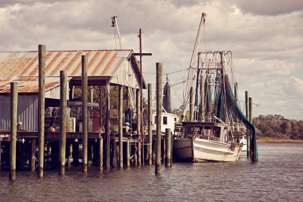
| The old fish house and dock | Several | 12 min | Changed |
| Fort Fisher ferry terminal | Safe Haven | Drive, 8 min | Standing |
The waterfront
Bay Street and the public dock
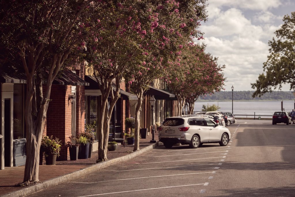
The strip of grass and benches along the river is the town's most filmed frontage: the Oak Island light is directly across the water and the shipping channel gives every shot movement without any set dressing. It is public land, open at all hours, and the light is best in the late afternoon when the sun is behind the town.
- Address
- Bay Street, Southport, North Carolina
- Status
- Standing
- Access
- Open
- Checked
- Aug 2026
The general store
An existing waterfront building, redressed with a wooden porch, a hand-painted sign and a period petrol pump for Safe Haven. All three were struck after the shoot. The building trades today under another name, and the thing to recognise is the roofline rather than the front.
- Address
- Bay Street waterfront, Southport, North Carolina
- Status
- Changed
- Access
- Open
- Checked
- Aug 2026
The streets
Howe Street
The main street running inland from the water, and the town's commercial spine. It has been dressed as a small town in several decades and several states. The buildings are unchanged; the businesses inside them turn over.
- Address
- Howe Street, Southport, North Carolina
- Status
- Standing
- Access
- Open
- Checked
- Aug 2026
Franklin Square Park
A square block of live oaks, a bandstand and an old town hall, used for the festival sequence in Safe Haven and for background in most of the rest. It is the single best illustration of why the town keeps being cast: it needs no dressing at all.
- Address
- Howe Street at East West Street, Southport, North Carolina
- Status
- Standing
- Access
- Open
- Checked
- Aug 2026
The residential grid: Caswell, Atlantic and Lord streets
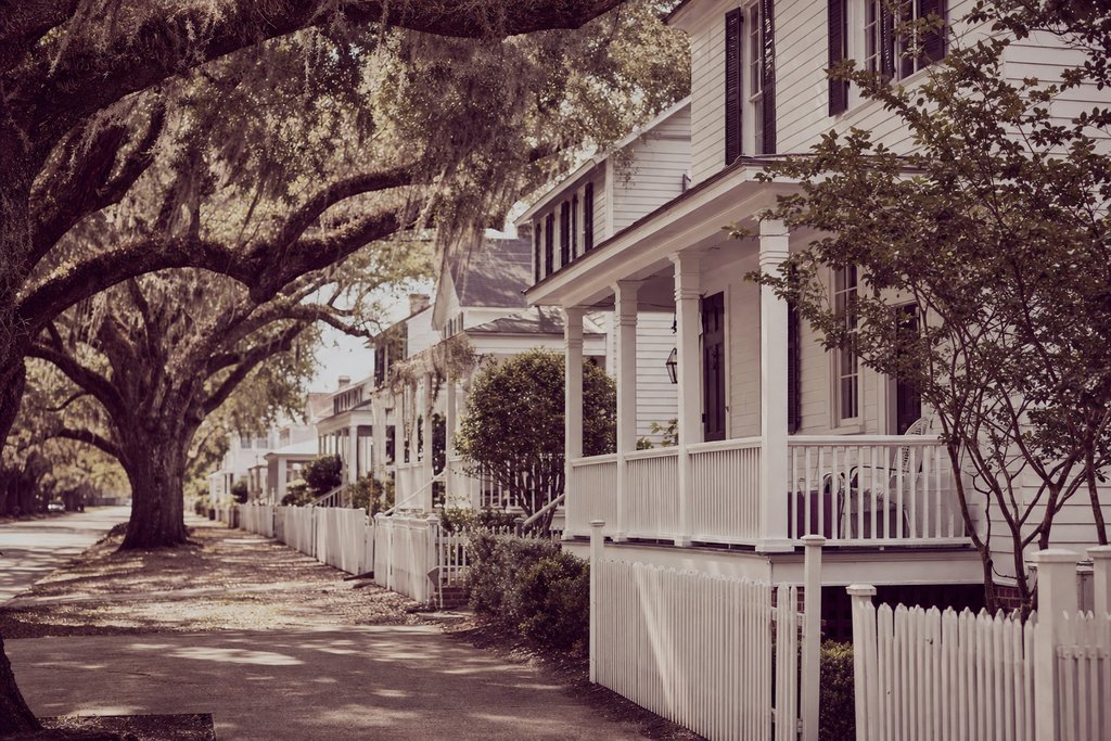
The cottages that appear as characters' homes are private houses on ordinary streets. Several are marked on commercial tour maps; none is open, and the owners did not choose to live in a location. Walk the streets, photograph from the footpath, and do not go up a driveway.
- Address
- Caswell, Atlantic and Lord streets, Southport, North Carolina
- Status
- Standing
- Access
- Private; streets open
- Checked
- Aug 2026
Dawson's Creek and the Wilmington corridor
The television series was based at the Wilmington studio and used Southport for exteriors across its run, together with Wilmington's riverfront, the Carolina Apartments and a string of beaches on Wrightsville and Kure. The series' fictional town does not correspond to any single real one; it is Southport's waterfront, Wilmington's streets and three separate beaches cut together.
That composite is worth understanding before planning a trip: no single walk reproduces the town on screen, because the town on screen was never in one place. The United States hub holds the rest of the American material, the location index filters all of it by town, and the USA master index lists the Wilmington entries separately for the same reason.
The ferry, and getting here
Southport–Fort Fisher ferry
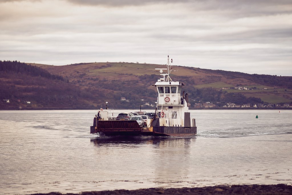
A working state vehicle ferry across the mouth of the Cape Fear River, thirty-five minutes each way, and the most pleasant approach to the town. It appears on screen in Safe Haven and is also the practical route north to Wilmington and Kure Beach.
- Address
- Ferry Road, Southport, North Carolina
- Status
- Standing
- Access
- Open, fare, seasonal timetable
- Checked
- Aug 2026
Southport has no rail service and no commercial airport. The practical arrivals are Wilmington, forty minutes north, and Myrtle Beach, an hour and a quarter south-west. Street parking in the historic grid is free and unmetered but fills by mid-morning in summer.
What has changed, and what has not
The buildings are largely unchanged; the frontages are not. Since 2013 the Safe Haven store dressing has been struck, two of the working fish houses on the dock have been demolished, and the waterfront has gained a boardwalk section that did not exist when the films were made. Franklin Square Park, Howe Street and the residential grid are as they were.
The town's own signage now marks several filming locations, which is convenient and also worth treating carefully: at least two of the markers describe scenes shot elsewhere in the county. Where this file and a marker disagree, the entry here says what was checked and when.
Why productions keep coming back
Four things make a small town useful to a location manager, and Southport has all four.
- Intact building stock. A grid of white clapboard houses and low commercial frontages with no post-war intrusion in the frame.
- No skyline. Nothing tall enough to date a shot or to have to keep out of it.
- Water on two sides. A tidal river, a working dock and an ocean horizon within a few hundred metres of each other.
- Proximity to a studio. Thirty miles from the Wilmington stages, which is inside the daily travel radius for a crew.
None of those is scenic in itself. Together they make a town that can be dressed as almost anywhere in coastal America between about 1940 and now, which is exactly what a production wants.
The town's own history
Southport was laid out in 1792 as Smithville, at the mouth of the Cape Fear River, and its purpose was the river, not the sea: pilots based here took ships up to Wilmington. The pilot houses along the waterfront are the oldest building type in the town and several survive.
The live oaks that make the streets photograph the way they do are a consequence of the same history: planted and protected over two centuries in a place that never had a reason to widen its roads. The town's ordinances still protect them, which is why a modern streetscape has not appeared underneath them.
Beyond the film locations
The maritime museum
Small, on Howe Street, and genuinely good on the river pilots, the blockade running during the Civil War, and the hurricanes. An hour, and the best context for everything else in the town.
- Where
- Howe Street, Southport, NC
- Time needed
- 1 hour
- Checked
- Aug 2026
Old Smithville Burying Ground
A shaded cemetery in the middle of the town with stones going back to the eighteenth century, many of them for people lost at the river mouth. Free and open.
- Where
- East Nash Street, Southport, NC
- Time needed
- 30 minutes
- Checked
- Aug 2026
Bald Head Island
Twenty minutes by passenger ferry from Deep Point Marina. No cars on the island, golf carts only, plus the oldest standing lighthouse in the state. A day trip, and the ferry books out in summer.
- Where
- Bald Head Island, NC
- Time needed
- A day
- Checked
- Aug 2026
Season and weather
Summer is hot, humid and busy, and it is also hurricane season; the Carolina coast runs a real risk from August through October, and evacuation orders happen. Spring and late autumn are the better times: mild, quiet, and the light is lower and kinder to the clapboard.
Winter is very quiet. Several businesses close for part of it and the ferry runs a reduced timetable, but the town is at its most photogenic with the oaks bare and the streets empty.
Practicalities
- Parking in the historic grid is free and unmetered, and fills by mid-morning in season.
- Getting here: Wilmington airport is forty minutes north, Myrtle Beach an hour and a quarter south-west. No rail.
- The ferry to Fort Fisher runs a seasonal timetable and the last sailing is earlier than most visitors expect.
- Tour maps sold locally mark filming locations. At least two markers describe scenes shot elsewhere in the county; where this file and a marker disagree, the entry here says what was checked and when.
Eating and staying
Southport's food is river and ocean seafood, sold plainly: shrimp, flounder, oysters in season, and hush puppies with everything. The waterfront restaurants trade on the view and the ones a block inland trade on the cooking, which is the usual arrangement in a small port.
Accommodation is inns and rentals, not hotels, and there are not many of them. Wilmington forty minutes north has the volume if the town is full, and Oak Island fifteen minutes away has beach rentals.
A note on the tour maps
Commercially sold filming-location maps are available in the town and are useful. At least two of the markers they carry describe scenes shot elsewhere in the county, and one identifies a private house that the current owners did not choose to have identified. Where this file and a map disagree, the entry here says what was checked and when.
The other productions that used this coast
Southport and Wilmington are usually written up as Nicholas Sparks country, and that undersells the corridor considerably. Three more productions used the same thirty miles, and two of them have locations that are more interesting than the Sparks ones because of what has happened to them since.
The River Court · One Tree Hill (2003–2012)
The riverside basketball court that the series used as its central meeting place was not a found location: it was built for the production on the Cape Fear riverfront in Wilmington, with the painted backboard and the mural wall behind it. It was dismantled after the series ended.
This is the entry that most often disappoints visitors, because the court appears in every guide and there is nothing on the ground. The riverwalk it stood beside is public and intact; the court is not there and is not coming back.
- Address
- Cape Fear riverfront, Wilmington, North Carolina
- Status
- Gone: a purpose-built set, dismantled
- Access
- Riverwalk open; nothing remains of the court
- Checked
- Aug 2026
Front Street, Wilmington · One Tree Hill (2003–2012)
The series' town centre is Wilmington's historic Front Street, and the café at its heart was an existing building dressed with a new frontage. The building stands and trades under a different name; the signage and window treatment were struck when the production ended.
- Address
- Front Street, Wilmington, North Carolina
- Status
- Changed
- Access
- Open, public street
- Checked
- Aug 2026
Hewletts Creek and the waterfront houses · Dawson's Creek (1998–2003)
The creek that gives the series its name is a tidal creek south-east of Wilmington, and the houses used for the two lead families are private waterfront homes on it. Neither is visible from a public road and neither is open; the creek itself is navigable by kayak from the public launches.
The series' town, like the film town in the Sparks adaptations, is a composite: Wilmington's riverfront, Southport's waterfront and three separate beaches cut together. No single walk reproduces it because it was never in one place.
- Address
- Hewletts Creek, New Hanover County, North Carolina
- Status
- Standing
- Access
- Private houses; creek public by water
- Checked
- Aug 2026
Southport and Wrightsville Beach · The Choice (2016)
The fifth Nicholas Sparks adaptation shot on this coast, and the most recent. It used the Southport waterfront, the residential streets north of Howe Street, and Wrightsville Beach twenty minutes east of Wilmington. The beach houses are private; the waterfront and the beach are public.
It is covered here rather than in the four-adaptation file because its locations are Southport's rather than its own.
- Address
- Southport waterfront and Wrightsville Beach, North Carolina
- Status
- Standing
- Access
- Public; individual houses private
- Checked
- Aug 2026
Why this corridor holds so many
Five productions in thirty miles is not a coincidence and it is not scenery. It is a studio at Wilmington inside daily travel distance of a town that needs no dressing, a state film incentive that ran for two decades, and a crew base deep enough that a series could be resident here for nine years. Take any one of those three away and the corridor does not exist.
Frequently asked questions
Why is Southport called Hollywood East?
The nickname belongs to the Wilmington–Southport corridor, not to Southport alone. A large studio complex opened at Wilmington in the mid-1980s, and the small river port thirty miles south became its standing small-town set: a walkable grid of white clapboard houses, live oaks and a working waterfront within half an hour of the stages.
What was filmed in Southport, North Carolina?
Safe Haven used the town extensively in 2013, A Walk to Remember shot here in 2002, and Dawson’s Creek used the waterfront and surrounding streets across its run. A long tail of features and series has used the same few blocks because they read as anywhere in coastal America.
Can you walk the Southport filming locations?
Yes. The waterfront, Franklin Square Park, Howe Street and the ferry terminal are within a ninety-minute walk of each other, and the town has free street parking. Only the private houses used on screen sit outside that circuit.
Is the Safe Haven store still there?
The building is, under a different name. The porch and the signage that made it the store on screen were built for the production and removed afterwards, so the silhouette matches and the frontage does not.