Location file
Monument Valley: Navajo, Goulding's Lodge & Forrest Gump
Monument Valley is the spine of this whole index. It is where American cinema built its idea of the west, in a sequence of films made from 1939 onwards, and it is where a single running shot in a 1994 comedy-drama made one stretch of ordinary highway into the most photographed road surface in the country.
It is also the entry where the practical information matters most, because two of the three things people come for are not where they assume and the third is genuinely dangerous if approached carelessly.
The three things to get right
| Site | Whose land | Fee | Status |
|---|---|---|---|
| The Gump road, US 163 | Utah state highway | None | Standing |
| Navajo Tribal Park loop | Navajo Nation | Tribal park fee | Standing |
| Goulding's Lodge and museum | Private | Museum donation | Standing |
The Forrest Gump road
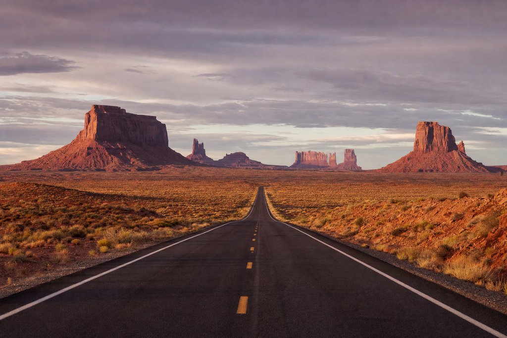
US Highway 163, near mile marker 13
The shot is taken looking south along the highway with the buttes filling the frame. It works because the road runs dead straight for several miles and the land drops away, so the buttes rise out of the tarmac.
This is a live highway. The speed limit is 65 mph, there is no shoulder at the crest, and people stand in the carriageway to take the photograph. There have been serious collisions. The safe method is to use the graded pull-off short of the rise, park completely off the tarmac, and take the photograph from the verge; the composition from the verge is very nearly the same.
- Address
- US 163, near mile marker 13, north of Mexican Hat, Utah
- Status
- Standing
- Access
- Public highway: park off the road, do not stand on it
- Checked
- Aug 2026
The Navajo Tribal Park
The valley floor and the scenic loop
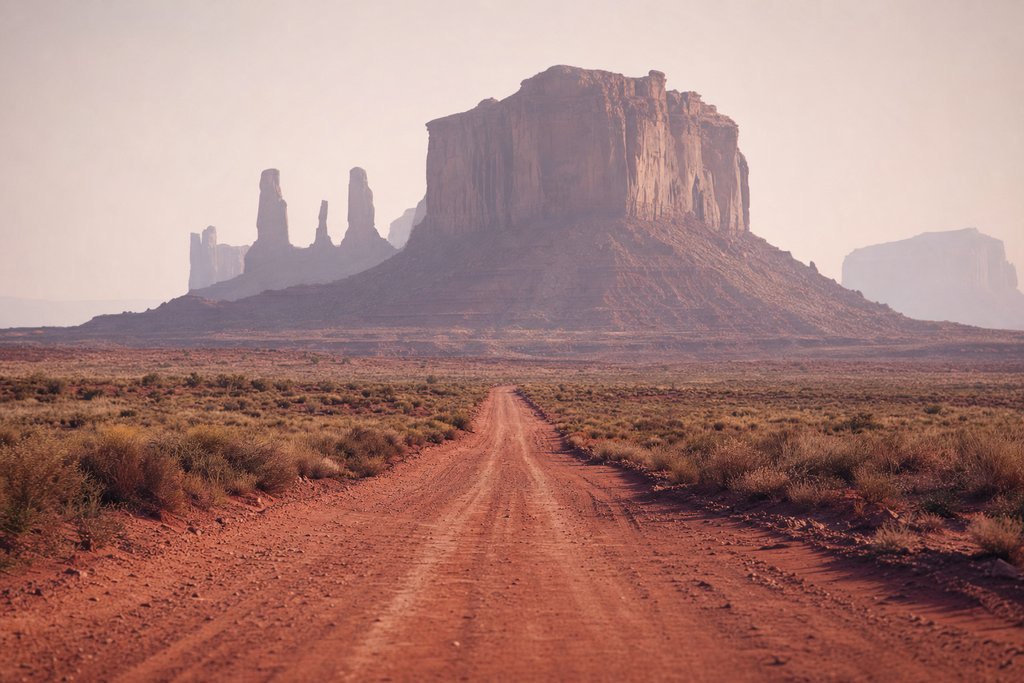
The valley itself is Navajo Nation land, administered as a tribal park with its own entrance fee. National park passes are not accepted. The seventeen-mile scenic drive is unsealed, rough in two or three places and normally passable in an ordinary car driven slowly in dry conditions; it closes after heavy rain.
The gate hours are shorter than most visitors expect and are seasonal. Arriving at five in the afternoon in winter means not getting in.
- Address
- Monument Valley Navajo Tribal Park, Oljato-Monument Valley, Utah
- Status
- Standing
- Access
- Open, tribal park fee, seasonal hours
- Checked
- Aug 2026
John Ford Point
The overlook used repeatedly from Stagecoach onwards, and the single most reproduced sightline in the western genre. It is on the scenic loop, has parking, and is where the guided tours stop. Photography from the point is free; the horse that is usually stationed there is a private arrangement and is not.
- Address
- Scenic loop, Monument Valley Navajo Tribal Park
- Status
- Standing
- Access
- Included in park fee
- Checked
- Aug 2026
Goulding's Lodge
The trading post and the film crews
Harry Goulding's trading post opened in the 1920s at the western edge of the valley, and the story that he took photographs of the buttes to Hollywood in 1938 and came back with a production is the origin of the entire western canon that follows. The lodge housed the crews.
It still operates as accommodation, and the original stone trading post behind it holds a small museum with production stills and equipment from the films made here. It is the one place in the valley where the film history is documented rather than implied.
- Address
- Goulding's Lodge, Monument Valley, Utah
- Status
- Standing
- Access
- Open; museum donation
- Checked
- Aug 2026
Practicalities
The valley straddles the Utah–Arizona line and the two states keep different clocks for part of the year: Arizona does not observe daylight saving, the Navajo Nation does. Phone signal is patchy to absent across most of the area. Fuel is at Kayenta to the south and Mexican Hat to the north, and there is very little between them.
Summer temperatures on the valley floor are extreme and the loop has no shade. Sunrise and the last hour before the gate closes are both better light and better temperature. Bring more water than seems necessary.
Respect and permissions
The valley is inhabited. Families live on the land the loop passes through, and photographing homes, livestock or people without permission is not acceptable regardless of what the road allows. Drone flying is prohibited across the Navajo Nation without a permit. Off-track walking is limited to the one marked trail; the rest of the valley requires a Navajo guide.
Where it fits in a wider trip
Monument Valley sits between the Utah parks and the Arizona canyon country, and most people reach it on a loop that takes in Moab, Page and the Grand Canyon. The USA master index lists Dead Horse Point, Double Arch and Horseshoe Bend along the same route, and the United States hub collects the rest. The same drive continues into California, and every address here is filterable in the location index.
How the valley was formed
The buttes are the remains of a sandstone plateau. What is left standing is the harder rock: de Chelly sandstone capping softer Organ Rock shale, and the shapes are what survived after everything around them eroded away over millions of years.
That is why the formations are flat-topped and steep-sided, not peaked, why they stand in isolation on a plain instead of in a range, and why they are the colour they are: iron oxide in the sandstone. The colour intensifies in low light, which is the whole reason sunrise and sunset are worth the early start.
What John Ford actually did here
Ford shot nine films in the valley between 1939 and 1964, and in doing so effectively invented the visual language of the western: a small group of figures against enormous vertical rock, filmed low so the buttes fill the frame. Almost every western made since quotes it.
The consequence for a visitor is that the valley reads as familiar on arrival even to people who have never seen a Ford film, because everything else has copied it. John Ford Point on the scenic loop is the specific sightline, and it is signposted.
Taking a guided tour
The self-drive loop covers about a third of what is accessible. Areas beyond it (the arches, the narrow canyons, the petroglyph sites, the sand dunes) can only be entered with a Navajo guide, and the tours run from the visitor centre and from Goulding's.
Two reasons to take one beyond the access. The vehicles are high-clearance and reach terrain a hire car should not attempt. And the commentary is from people whose families live on the land, which is a different and better account than a brochure gives.
Where to stay
| Option | Where | Note |
|---|---|---|
| The View Hotel | Inside the tribal park | Every room faces the mitten buttes; books far ahead |
| Goulding's Lodge | West of the park | The historic option, with the trading-post museum |
| Kayenta | 40 min south, Arizona | Chain motels, fuel, supermarket |
| Mexican Hat | 25 min north, Utah | Very small; nearest to the Gump road |
Staying inside or immediately beside the park is what makes sunrise practical, and sunrise is the reason to be here.
Two clocks and one border
The valley straddles the Utah–Arizona line. Arizona does not observe daylight saving; the Navajo Nation, which covers this area, does. So for half the year a phone can show two different times within a few miles, and a tour booked for eight in the morning needs the timezone confirmed rather than assumed. This catches people out more than any other practicality here.
Practical notes
- Fuel at Kayenta and Mexican Hat and very little between.
- Signal is patchy to absent across most of the area on every network.
- Water: more than seems necessary. The loop is exposed and there is no shade.
- Alcohol is prohibited on the Navajo Nation.
- Drones require a permit and are otherwise prohibited.
- People live here. Homes, livestock and residents along the loop are not subjects; ask before photographing anyone, and do not photograph dwellings.
Frequently asked questions
Where is the Forrest Gump road in Monument Valley?
On US Highway 163 in Utah, about thirteen miles north of Mexican Hat, looking south towards the buttes. It is a live highway with a 65 mph limit and no formal parking at the exact spot; the safe approach is the graded pull-off short of the crest, then walk.
Is Monument Valley a national park?
No. It is a Navajo Tribal Park on Navajo Nation land, with its own entrance fee, its own opening hours and its own rules. National park passes are not valid, and the park closes earlier than most visitors expect.
Can you drive into Monument Valley in an ordinary car?
The seventeen-mile scenic loop is unsealed and rough in places but is normally passable in a two-wheel-drive car driven carefully in dry weather. After rain it can close. Guided tours in high-clearance vehicles reach areas the loop does not.
What is Goulding’s Lodge?
A lodge and trading post at the western edge of the valley, founded in the 1920s, which housed the film crews that made the classic westerns here from 1939 onwards. It still operates as accommodation and keeps a small museum in the original trading post building.