Route file
California Roadtrip: San Diego To San Francisco
There are two ways to drive from San Diego to San Francisco and they are not variants of the same trip. Interstate 5 runs up the Central Valley and takes eight hours. The coast route runs another hundred miles and takes three days, because Highway 1 between San Simeon and Carmel cannot be hurried and should not be.
This file sets out the coast route in stages, with the drive times that are real, not the ones a mapping app gives, the stops worth stopping for, and the single risk that can undo the whole plan: the Big Sur landslide closures.
The two routes compared
| Route | Distance | Driving time | Minimum sensible days |
|---|---|---|---|
| Interstate 5 | ~500 miles | 8 hours | 1 |
| US 101 (inland-coastal) | ~530 miles | 9 hours | 2 |
| Highway 1 (full coast) | ~600 miles | 13–15 hours | 3 |
The interstate is not scenic and is not meant to be; it is how Californians actually make this journey when they have to be somewhere. If you have one day, take it and fly the other leg. If you have three, take the coast.
Stage one: San Diego to Santa Barbara
About 220 miles and, realistically, five to six hours with stops: more if you hit Los Angeles between three and seven, which is worth planning around instead of enduring.
La Jolla and the northern San Diego beaches
An hour out of the city and worth the first stop: cliffs, a cove, and a resident colony of sea lions on the beach that has generated a long-running argument about who the beach belongs to. Parking is metered and hard on summer weekends.
- Where
- La Jolla, San Diego County, California
- Time needed
- 1 hour
- Checked
- Aug 2026
Getting through Los Angeles
The through route is I-5 to I-405 or the coast on Pacific Coast Highway. The coast is slower and more interesting; the freeway is faster except in the afternoon peak, when it is not faster at all. If you are stopping, the Los Angeles entries in the master index (Griffith Observatory, the Bradbury Building, Angels Flight) are all within a few miles of downtown.
- Where
- Los Angeles County, California
- Time needed
- 2–4 hours to cross
- Checked
- Aug 2026
Santa Barbara
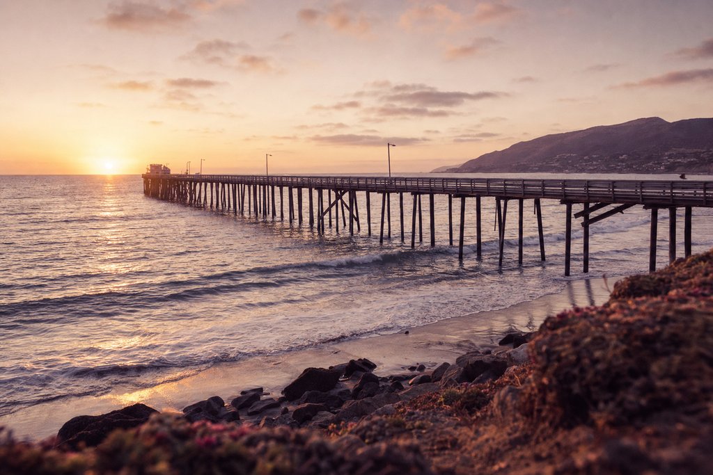
The natural first night. A Spanish-revival town on a south-facing coast with a mission, a pier and a walkable centre, ninety miles north of Los Angeles. It is expensive and it is the last comfortable stop before the route gets remote.
- Where
- Santa Barbara, California
- Time needed
- Overnight
- Checked
- Aug 2026
Stage two: Santa Barbara to Cambria or San Simeon
About 150 miles and four hours with stops. This is the transition: the road leaves the beach towns behind and climbs into ranch country, and the traffic thins to almost nothing.
Solvang and the Santa Ynez Valley
An inland detour on Highway 154 through wine country, rejoining the coast at Santa Maria. It adds about forty minutes and is the better road; Solvang itself is a Danish-themed town that is either a diversion or a reason to keep driving, depending on temperament.
- Where
- Santa Ynez Valley, California
- Time needed
- 1–2 hours
- Checked
- Aug 2026
Pismo Beach and San Luis Obispo
The last stretch of easy coast. San Luis Obispo is a university town with a good main street and is the practical lunch stop; Pismo has a long flat beach that cars are still allowed to drive on in one section.
- Where
- San Luis Obispo County, California
- Time needed
- 1–2 hours
- Checked
- Aug 2026
Hearst Castle and the elephant seals
The hilltop estate above San Simeon is open by guided tour only and needs booking. Four miles north, the Piedras Blancas rookery holds several thousand elephant seals on the beach beside a free boardwalk, and it is the more remarkable of the two.
- Where
- San Simeon, California
- Time needed
- Half a day for both
- Checked
- Aug 2026
Stage three: Big Sur to Monterey
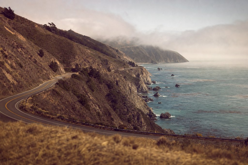
Ninety miles and, honestly, four hours. This is the reason for the whole route: a two-lane road cut into a cliff face above the Pacific with no towns, no fuel for long stretches and a speed that averages under forty.
Bixby Creek Bridge
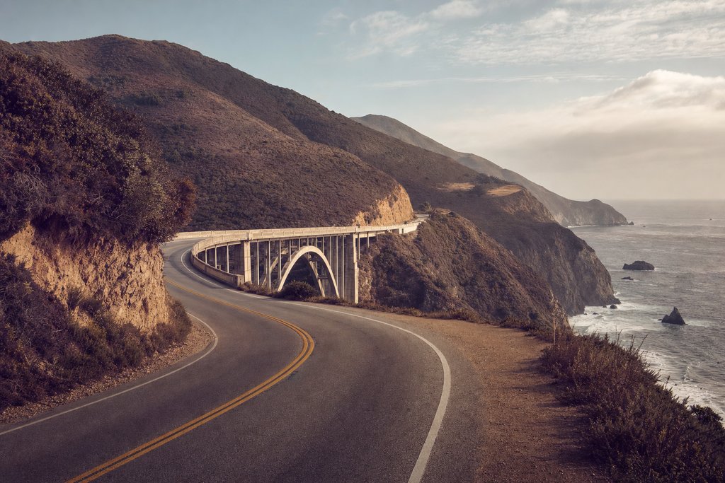
The concrete arch bridge that appears in more coastal establishing shots than any other piece of American road engineering. There is unsurfaced parking at the northern end; the southbound approach gives the classic angle. It is thirteen miles south of Carmel.
- Address
- Highway 1, Big Sur, Monterey County
- Status
- Standing
- Checked
- Aug 2026
McWay Falls and Julia Pfeiffer Burns State Park
A waterfall that drops onto a beach in a cove, seen from a short cliff path. Parking is a small state park lot that fills by mid-morning; there is roadside parking that requires a walk.
- Where
- Highway 1, Big Sur
- Time needed
- 45 minutes
- Checked
- Aug 2026
Monterey and Carmel
The northern end of the hard driving. Monterey has the aquarium and the old cannery frontage; Carmel is a small, expensive, very pretty town with a beach at the bottom of the hill. Either works as the last night.
- Where
- Monterey County, California
- Time needed
- Overnight
- Checked
- Aug 2026
The closure problem
Highway 1 through Big Sur is cut into an unstable cliff and it slips. It has been fully closed for months at a time more than once in the last decade, sometimes with the closure in the middle of the scenic stretch so that the road is open from both ends and does not connect.
The consequences are practical. A closure means backtracking to US 101 over the Nacimiento-Fergusson road or, more often, driving all the way back to San Luis Obispo. Accommodation booked in Big Sur becomes unreachable. Check the state transport department's current closures when you book and again the day before, and have the inland route in mind.
Stage four: Monterey to San Francisco
About 120 miles and two and a half hours on Highway 1 through Santa Cruz and Half Moon Bay, or under two on US 101 through San Jose. The coast road is pleasant and no longer dramatic; the interstate is faster and duller. Either way, arriving in San Francisco after five means arriving in traffic.
Practical notes for the whole drive
- Fuel: fill up at San Simeon before Big Sur and at Carmel afterwards. Fuel in Big Sur itself is available, limited and very expensive.
- Phone coverage: absent for long stretches of the Big Sur cliffs. Download the maps before leaving. The prepaid SIM file covers which networks do best on this coast.
- Fog: the northern coast is fogged in most summer mornings and clears by midday. Driving Big Sur at nine in July often means driving it in cloud.
- Hire cars: one-way drop-off between San Diego and San Francisco carries a fee with most companies. Factor it in instead of discovering it.
- Tipping and tolls: see the tipping file; the Golden Gate is tolled electronically with no cash option.
Doing it in the other direction
North to south is the more common direction and puts you on the ocean side of the road, with the pull-offs on your right. That is a genuine advantage on Highway 1: turning left across the carriageway to reach a viewpoint on a blind cliff bend is the single most dangerous thing most people do on this drive.
Against that, south to north gives better light for photographs in the afternoon and puts the best stretch on day three rather than day one. Both work; the northbound driver should be disciplined about only stopping at pull-offs on their own side.
What this route is worth
The coast route costs two extra days and a hundred extra miles, and the payoff is concentrated in about ninety of them. If the Big Sur stretch is closed, the honest answer is that the rest of the coast road is pleasant, not exceptional and the interstate plus a flight is a better use of the time.
For the other American files see the United States hub; for the film locations along this coast, the master index covers Bixby Creek, the Bodega schoolhouse, Fort Point and Mission San Juan Bautista, all of which are on or near this route.
What each leg is actually like to drive
Distance is a poor guide on this route because the road changes character four times. A summary in driving terms rather than mileage:
| Leg | Road | Character | Average speed |
|---|---|---|---|
| San Diego – Los Angeles | I-5 / I-405 | Multi-lane, heavy, unremarkable | 45–65 mph |
| Los Angeles – Santa Barbara | US 101 | Fast, coastal at Ventura | 60 mph |
| Santa Barbara – San Simeon | US 101 / SR 1 | Ranch country, quiet | 55 mph |
| San Simeon – Carmel | SR 1 | Cliff road, two lanes, no shortcut | 25–35 mph |
| Carmel – San Francisco | SR 1 / US 101 | Suburban then urban | 50 mph |
The ninety miles from San Simeon to Carmel take four hours with stops and cannot be compressed. Every itinerary that fails on this route fails there.
Where to stay, by stage
Accommodation on this coast is the constraint, not the driving. Big Sur has a very small number of rooms at very high prices, booked months ahead, and no supermarket. The practical pattern is to sleep at either end of the hard stretch, not in it.
- Night one: Santa Barbara. Expensive but plentiful, walkable, and the last comfortable town before the route thins out. Cheaper alternatives inland at Goleta and Ventura.
- Night two: Cambria or San Simeon. Small, quiet, and positioned at the southern end of the Big Sur stretch so it can be driven in the morning light.
- Night three: Monterey, Pacific Grove or Carmel. The northern end. Monterey has the most rooms and the best value; Carmel is prettier and dearer.
Camping at the state parks along the route books out six months ahead in summer and is released on a rolling window. It is the cheapest way to sleep on this coast by an order of magnitude and it requires planning that most road trips do not get.
Fog, and why the timing matters
The central and northern coast is fogged in on most summer mornings. The marine layer sits on the water overnight, pushes inland, and burns off somewhere between ten and one depending on the day. That has three practical consequences.
First, driving Big Sur at nine in July often means driving it in cloud with no view at all. Second, the fog is thickest at the coast and clears inland, so a detour inland can buy back a morning. Third, and this is the one people find counter-intuitive, the Californian coast in summer is cold. Sea temperatures in the low teens keep the air down with them, and a July afternoon at Monterey can be fifteen degrees while the Central Valley an hour east is thirty-eight.
September and October are the clearest months on this coast and are the better time to drive it.
Fuel, food and phone signal
- Fuel: fill at San Simeon going north or Carmel going south. Fuel inside Big Sur exists, is limited, and is priced accordingly.
- Food: the same applies. There is very little between Ragged Point and Big Sur village, and what there is closes early. Carry water and something to eat.
- Signal: absent for long stretches of the cliffs on every network. Download offline maps; the prepaid SIM file covers which network does best here, and the honest answer is that none of them does well.
- Toilets: at the state park entrances and the few businesses. Not otherwise.
Detours worth the time
The 17-Mile Drive, Pebble Beach
A private toll road around the Monterey Peninsula with cypress headlands and a famous lone tree. It costs money, it is slow, and it is genuinely beautiful. About ninety minutes.
- Where
- Monterey Peninsula, California
- Time needed
- 1.5 hours
- Checked
- Aug 2026
The Santa Ynez wine country
Inland on Highway 154 out of Santa Barbara, rejoining at Santa Maria. Adds about forty minutes and is a better road than the freeway it replaces.
- Where
- Santa Ynez Valley, California
- Time needed
- 2 hours
- Checked
- Aug 2026
Point Reyes, north of San Francisco
If the trip continues past the city: an hour north, a peninsula of cliffs, a lighthouse at the bottom of three hundred steps, and elephant seals in winter. It is the coast the city forgets.
- Where
- Marin County, California
- Time needed
- A day
- Checked
- Aug 2026
Hiring the car
Three things to settle before booking. One-way drop-off between San Diego and San Francisco carries a fee with most companies and it is substantial; check it rather than discovering it. Toll roads in Southern California and the Bay Area bridges are electronic with no cash lane, so the hire company's transponder arrangement matters. And a convertible is a worse car for this route than it sounds: the fog is cold and the cliff road needs a windscreen you can see through.
An ordinary mid-size car is the right choice. Nothing on this route requires clearance, and the Big Sur parking pull-offs are small enough that a large vehicle is a liability.
If Big Sur is closed
Check the state transport department's closure list when you book and again the day before. If the stretch is shut, the options are the Nacimiento-Fergusson road over the ridge, which is narrow, slow and itself frequently closed, or backtracking to US 101 at San Luis Obispo and rejoining the coast at Monterey.
The honest advice in that case: take the inland route, do not try to see the closed stretch from both ends, and use the time saved on the Monterey Peninsula instead. The coast road without Big Sur is a pleasant drive, not a great one, and the interstate plus a flight is a better use of three days.
The two cities at the ends
San Diego, before setting off
Balboa Park, the zoo, the Gaslamp Quarter and a string of beaches north to La Jolla. A day before the drive is worth it, and picking up the hire car on the way out of the city rather than at the airport avoids the first hour of freeway.
- Where
- San Diego, California
- Time needed
- 1–2 days
- Checked
- Aug 2026
San Francisco, at the end
Drop the car. Parking is expensive, the hills are punishing on a hire car's clutch, and the city is one of the few in the United States that works entirely without one. Fort Point and the Golden Gate approach are covered in the master index.
- Where
- San Francisco, California
- Time needed
- 2–3 days
- Checked
- Aug 2026
Driving the cliff road safely
Highway 1 through Big Sur is a two-lane road with a rock face on one side and a drop on the other, blind bends, and a lot of drivers looking at the view. Four habits that matter:
- Only stop on your own side. Turning left across the carriageway into a pull-off on a blind bend is the single most dangerous thing people do on this road. Northbound drivers have the ocean side and should use it.
- Use the turnouts. Slower vehicles are required to pull over when five cars are behind; that includes you when you are sightseeing.
- Watch for cyclists. The route is a well-known long-distance ride and there is no shoulder.
- Fuel and brakes. Long descents; engine-brake rather than riding the pedal, and fill up before entering.
What the coast costs
This is an expensive drive and it is worth knowing where the money goes. Accommodation is the largest line by a distance, and it rises steeply on the Monterey Peninsula and in Big Sur. Fuel is cheap by Australian or British standards. Park entry adds up if several are visited: an annual national parks pass pays for itself in about three.
The savings that actually work: sleep inland at Salinas or Paso Robles instead of on the coast, eat one meal a day from a supermarket, and book campsites six months out if camping at all. The savings that do not work: skipping the coast road, which is the entire point of the trip.
Wildlife along the route
- Elephant seals at Piedras Blancas, four miles north of San Simeon: several thousand on the beach beside a free boardwalk, year round with peaks in winter.
- Sea otters in the kelp at Moss Landing and in Monterey Bay, visible from the shore with patience.
- Grey whales migrating south December to February and north March to May, often visible from the cliff pull-offs.
- California condors reintroduced along the Big Sur coast: very large, very rare, and unmistakable if one goes over.
None of these needs a boat or a ticket. All of them need somewhere safe to stop, which brings it back to the turnouts.
Frequently asked questions
How long does it take to drive from San Diego to San Francisco?
On Interstate 5 it is about eight hours of driving for roughly 500 miles. On the coast road it is closer to 600 miles and cannot sensibly be done in less than three days, because Highway 1 through Big Sur averages under 40 mph and there is nowhere to make up time.
Is Highway 1 through Big Sur open?
It is subject to landslide closures and has been fully closed for months at a time more than once in the last decade. The state transport department publishes current closures, and the answer changes; check before committing to the coast route rather than assuming it is open.
What is the best stop between San Diego and San Francisco?
Depends what you want. For a single stop, Santa Barbara at roughly the one-third point is the most comfortable. For the drive itself, the stretch of Highway 1 between San Simeon and Carmel is the reason the route exists.
Do you need to book accommodation in advance on this drive?
Yes, in summer and at any weekend. Big Sur has very few rooms and they are expensive and booked months ahead; Cambria and Monterey are the practical alternatives at either end of the closed stretch.