Location file
Nicholas Sparks Filming Locations, from Savannah to Rodanthe
Four Nicholas Sparks adaptations were shot within a day's drive of each other on the Atlantic seaboard, and they are usually written up as one trip. They can be, but not casually: the coast bends, the barrier islands are reached by long causeways, and the hundred and eighty miles between the southernmost and northernmost location take the better part of five hours.
This file takes them in geographic order from south to north (Tybee Island, Southport, Wilmington, Rodanthe) with the addresses, what each place was used for, and its status now. The fifth adaptation, The Notebook, sits three hundred miles further south in South Carolina and has its own file.
The four productions, and where each one actually filmed
| Film | Year | Principal location | State |
|---|---|---|---|
| A Walk to Remember | 2002 | Wilmington and Southport | North Carolina |
| Nights in Rodanthe | 2008 | Rodanthe, Hatteras Island | North Carolina |
| The Last Song | 2010 | Tybee Island and Savannah | Georgia |
| Safe Haven | 2013 | Southport | North Carolina |
Tybee Island and Savannah · The Last Song (2010)
The beach house on the north end
The house used for the summer beach home is a private property on the north end of Tybee Island, eighteen miles east of Savannah. It is set behind a dune line and there is no public access; the beach in front of it is public and is the shot most people want anyway.
- Address
- North end, Tybee Island, Georgia
- Status
- Standing
- Access
- Private house; beach public
- Checked
- Aug 2026
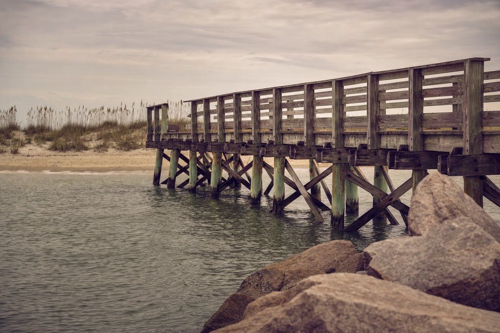
Tybee Island Pier and Pavilion
The pier carries several of the film's evening scenes and is a public structure with free access, open into the night. Parking on Tybee is metered year round and enforced.
- Address
- 16th Street, Tybee Island, Georgia
- Status
- Standing
- Access
- Open
- Checked
- Aug 2026
Savannah itself supplies the town scenes, and the city's squares are covered more fully in the Savannah file and the USA master index.
Southport · Safe Haven (2013) and A Walk to Remember (2002)
Southport is the densest single location on this coast: two of the four films used it, a long-running television series used it, and the town is small enough that the whole circuit is a ninety-minute walk. The Southport file maps it street by street; the entries below are the ones specific to these two films.
The waterfront general store
The store at the centre of Safe Haven was an existing building on the waterfront, redressed with a new sign and a new porch for the shoot. Both were struck afterwards and the building now trades under a different name, so the shape is the film's and the frontage is not.
- Address
- Bay Street waterfront, Southport, North Carolina
- Status
- Changed
- Access
- Open
- Checked
- Aug 2026
Franklin Square Park
The live-oak park in the middle of town, used for the festival sequence. It is a public park with benches and no entry charge, and the trees are the reason the town photographs the way it does.
- Address
- Corner of Howe Street and East West Street, Southport, North Carolina
- Status
- Standing
- Access
- Open
- Checked
- Aug 2026
The Southport–Fort Fisher ferry
The vehicle ferry across the Cape Fear River appears in both films and is a working state service, not a set. It takes about thirty-five minutes and carries cars; it is also the fastest way north towards Wilmington in summer traffic.
- Address
- Ferry Road, Southport, North Carolina
- Status
- Standing
- Access
- Open, fare
- Checked
- Aug 2026
Wilmington · A Walk to Remember (2002)
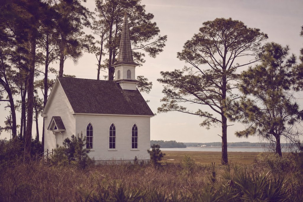
The chapel
The white weatherboard church used for the closing scenes stands in the countryside outside Wilmington. It is an active parish building, not a set, and services take priority over visitors; the exterior can be seen from the road at any time.
- Address
- Rural New Hanover County, near Wilmington, North Carolina
- Status
- Standing
- Access
- Exterior visible; interior in use
- Checked
- Aug 2026
Wilmington historic riverfront
The town scenes were shot along Front Street and the riverwalk. The district has been substantially restored since 2002, so it is tidier and busier than the film, but the buildings and the sightlines are the same.
- Address
- Front Street, Wilmington, North Carolina
- Status
- Changed
- Access
- Open
- Checked
- Aug 2026
Rodanthe · Nights in Rodanthe (2008)
The inn, and the reason it is the most instructive entry on this coast
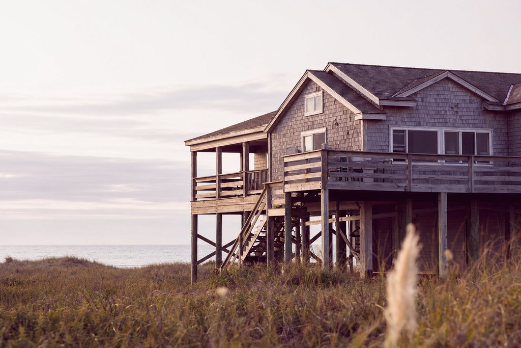
The house that plays the inn is the clearest example on the whole site of why a location file needs a status line. It was not demolished and it was not replaced: it was moved. Erosion took the beach out from under it until it stood in the surf at high tide, and in 2010 it was jacked up and relocated inland within Rodanthe, where it now works as a holiday rental.
So the building is authentic, the address is not the filming address, and the beach in the film no longer exists. Anyone standing where the camera stood is standing in the Atlantic.
- Address
- Rodanthe, Hatteras Island, North Carolina
- Status
- Changed (relocated 2010)
- Access
- Private rental; visible from the road
- Checked
- Aug 2026
Rodanthe Pier
A working fishing pier on the ocean side, and the one structure in the village that has been filmed by everyone who has come here. It charges a small walk-on fee and is open early.
- Address
- Highway 12, Rodanthe, North Carolina
- Status
- Standing
- Access
- Open, small fee
- Checked
- Aug 2026
Highway 12 and the Pea Island crossing
The road north from Rodanthe is a single carriageway along a barrier island a few hundred metres wide, and it is regularly overwashed and closed. It is also the drive that makes this trip worth taking. Check the state transport advisories before setting out in autumn.
- Address
- NC Highway 12, Pea Island, North Carolina
- Status
- Changed (realigned after storm damage)
- Access
- Open, subject to closure
- Checked
- Aug 2026
Driving the coast in three days
Day one: Tybee Island and Savannah, then the four-hour run north to Southport. Day two: Southport on foot in the morning, the ferry across the Cape Fear River, Wilmington in the afternoon. Day three: the long drive up to Hatteras Island, which takes five hours from Wilmington and is the least direct part of the route.
Doing it in reverse is easier in summer, because the Outer Banks changeover traffic on a Saturday can add two hours to the Rodanthe leg. For the practical side of an American road trip: distances, tolls, phone coverage on the barrier islands: see travel tips and the prepaid SIM file.
What has changed since these films were made
The coast rewrites itself faster than the productions that used it. Since 2008 the Rodanthe house has moved, Highway 12 has been realigned twice after storm breaches, the Southport store frontage has been struck, and Wilmington's riverfront has been substantially rebuilt. Only the chapel outside Wilmington and Franklin Square Park in Southport are unchanged in a way a visitor would notice.
That rate of change is the argument for dating every entry. The location index lets you filter this coast by status if you want to see only what still stands.
Why this coast, and why it keeps eroding
The Outer Banks are barrier islands: long, narrow sandbars sitting a few kilometres off the mainland, built and rebuilt by the ocean. They migrate landward over time, which is a normal geological process and a serious problem for anything built on them.
That is the context for the Rodanthe house. It was not badly sited by the standards of when it was built; the island moved out from under it. Several neighbouring houses have since collapsed into the surf and others have been relocated inland, and Highway 12 has been realigned more than once after storm breaches.
For a location file the implication is unusual and worth stating: on this coast the changed status is often literal. The building is the same and the ground it stands on is not.
Wilmington as the engine
A large studio complex opened at Wilmington in the mid-1980s and made coastal North Carolina the most-filmed shoreline in the country outside California. Everything in this file except the Georgia locations sits inside its daily travel radius.
The lot itself is a working studio and is not open to visitors, which is the difference between it and Burbank. What is open is everything the productions used outside it: the riverfront, the beaches at Wrightsville and Kure, and Southport thirty miles south.
Driving the coast, in detail
| Leg | Distance | Time | Note |
|---|---|---|---|
| Savannah – Southport | ~300 miles | 4.5 hours | Interstate most of the way |
| Southport – Wilmington | 30 miles | 45 min, or ferry + 30 | The ferry is the better route |
| Wilmington – Rodanthe | ~250 miles | 5 hours | No direct coastal road; inland then east |
| Rodanthe – Nags Head | 30 miles | 45 min | Highway 12, closure-prone |
The Wilmington to Rodanthe leg is the one people underestimate. There is no coastal road: the route runs inland to Jacksonville and New Bern and comes back east, and the last stretch is a single carriageway along a barrier island.
Storms, closures and timing
Hurricane season runs from June to November with the peak in August and September, and it is a real constraint on this coast, not a formality. Highway 12 is overwashed and closed regularly, mandatory evacuations of Hatteras Island happen, and accommodation is non-refundable more often than not.
Late spring, May and early June, is the best window: warm, quiet, before the school holidays and before the season. October is the second best if the forecast is clear.
Where to stay along the route
- Southport or Wilmington for the first two days. Southport is small and charming; Wilmington has more rooms and more to eat.
- Nags Head or Kill Devil Hills for the Outer Banks, rather than Rodanthe itself: more accommodation, and forty minutes from the village.
- Tybee Island or Savannah at the southern end, covered in the Savannah file.
Weekly rentals dominate the Outer Banks and change over on Saturdays, which is why Saturday traffic on Highway 12 can add two hours to the drive. Moving on any other day is materially easier.
The fifth adaptation, and why it is filed elsewhere
Four adaptations are covered above. A fifth, The Choice (2016), was also shot on this coast, and its locations are Southport's rather than its own: the same waterfront, the same residential streets, plus Wrightsville Beach twenty minutes east of Wilmington.
It is therefore filed in the Southport file, alongside the two other productions that used those streets: because a visitor standing on Bay Street is standing in all three at once, and splitting them across three pages would make that harder to see rather than easier.
The full index, filterable by production and by whether a location still stands, is at the location index.
Frequently asked questions
Which Nicholas Sparks films were shot in North Carolina?
A Walk to Remember at Wilmington, Nights in Rodanthe on Hatteras Island, The Last Song on Tybee Island in Georgia and Safe Haven at Southport. The Notebook is the outlier: it is set in North Carolina and was shot almost entirely in South Carolina, which is why it has a file of its own.
Is the house from Nights in Rodanthe still there?
Yes, but it is not where it was filmed. Erosion left the house standing in the surf, and in 2010 it was lifted and moved inland within Rodanthe, where it now operates as a rental property. The beach frontage seen in the film has been lost to the sea.
Can you visit the Safe Haven locations in Southport?
Most of them, yes. The waterfront, the dock, Franklin Square Park and the general store frontage are all on public streets in a town small enough to walk in an afternoon. The house used for Katie is private and stands outside the centre.
How far apart are the Nicholas Sparks locations?
The coastal stretch runs about a hundred and eighty miles from Southport in the south to Rodanthe on Hatteras Island in the north, but there is no fast road between them. Allow three days: one for Wilmington and Southport, one for the drive up the Outer Banks, one for Rodanthe and the return.